
Your phone’s GPS doesn’t just show a dot on a map; it combines satellite timing, Wi‑Fi, cell towers, and network data to estimate where you are. You get fast fixes, better indoor startup, and app support for route guidance, rides, weather, and safety. But accuracy shifts with buildings, cover, and settings, so the real question is how much location data your device is giving away.
What GPS on a Phone Does
Your phone’s GPS receiver uses signals from at least four satellites to calculate its position in less than a second. In GPS basics, you learn that the device converts those signals into latitude and longitude, so maps can place you accurately.
You’re not just seeing a dot; you’re getting a measured fix that helps apps understand where you are. Whenever you grant location permissions, you let trusted apps access that fix for route guidance, check-ins, or local services.
The system can then combine GPS data with Wi-Fi and cell signals to improve speed and reliability. In open outdoor conditions, you can expect meter-level accuracy, and that precision helps you feel connected, oriented, and in control wherever you go.
How Phone GPS Works
Your phone receives weak signals from at least four GPS satellites and measures their timing to estimate distance.
It then triangulates those distances to compute your latitude, longitude, and, in some cases, altitude with meter-level accuracy.
To speed the fix, it can also use assisted GPS data from Wi-Fi, cell towers, and network services under satellite conditions aren’t ideal.
Satellite Signal Reception
When your phone GPS is active, its receiver listens for signals from at least four orbiting satellites and uses the timing differences between them to calculate your position in under a second.
You’re not relying on guesswork; you’re reading tiny timing codes that travel from space to your device. Strong satellite signal strength helps your phone lock on quickly, while orbital signal interference from buildings, weather, or nearby electronics can weaken reception. To stay connected, your handset continuously filters noise and compares signal quality across satellites. If one path degrades, the receiver seeks a cleaner channel and keeps the data stream stable. That’s why your location stays useful for maps, delivery apps, and shared status updates when conditions support a clear sky.
Triangulating Exact Position
Once your phone has locked onto at least four satellites, it can triangulate exact position using comparing the tiny timing differences in each signal and converting those measurements into latitude and longitude.
You’re seeing a precise position calculation that solves for three spatial coordinates and clock error at once.
Because each satellite sits in a different part of the sky, signal geometry matters: wider separation sharpens the solution, while clustered satellites weaken it.
Your device measures how long each radio burst took to arrive, then matches those ranges to intersecting spheres around the satellites.
The overlap gives your location in space, and the math updates fast enough for wayfinding.
In clear conditions, you’ll usually get meter-level accuracy, so you can trust the map and stay confidently oriented.
Assisted GPS Data
How does assisted GPS make your phone lock faster? It lets your device use network data to narrow the search before it listens for satellites. Your phone receives ephemeris, time, and coarse location hints from cell towers or Wi-Fi, then it locks onto four or more satellites with less delay.
That support strengthens signal acquisition, improves indoor start-up, and reduces battery drain. These assisted gps benefits help you stay connected to your map, family, or ride status whenever you’re moving through familiar spaces or a new city.
Still, assisted gps limitations matter: you need cellular coverage, and accuracy drops as networks fail, buildings block signals, or you’re off-grid. In practice, A-GPS works as a cooperative layer, not a replacement for satellite triangulation.
Why Phones Use Wi‑Fi and Cell Towers
Your phone uses Wi‑Fi and cell towers to estimate position whenever GPS alone is slow or weak.
It measures nearby access points and tower signals, then triangulates them with satellite data to produce a faster location fix.
This hybrid method improves responsiveness indoors, in cities, and anywhere direct GPS signals degrade.
Wi‑Fi Positioning
Why do phones rely on Wi‑Fi and cell towers alongside GPS? You get faster, steadier location fixes because Wi‑Fi positioning adds dense, local reference points that GPS can’t always provide indoors or near obstructions.
Your phone scans nearby access points, compares signal patterns with hotspot mapping databases, and uses wireless fingerprinting to estimate where you are. This method works well in apartments, offices, malls, and campuses, where satellite signals weaken. It also reduces time to initial fix, so you don’t wait for a full satellite lock before apps can guide you.
Via blending these signals, your device gives you a shared, resilient positioning system that keeps you connected, oriented, and confidently included in the map.
Cell Tower Triangulation
Even whenever GPS is available, phones still lean on cell towers to tighten location estimates and stay responsive in weak-signal conditions. You’re matched to multiple towers, then your phone compares tower signal strength, timing, and sector geometry to infer where you are.
Via reading nearby cell sectors, it narrows position to a smaller area than one tower alone could provide. This matters whenever you’re indoors, in a dense neighborhood, or moving between cells, because the network can still identify your approximate zone.
You benefit from this because your device stays connected to the people and services you rely on, even whenever satellite data isn’t ideal. Cell tower triangulation doesn’t replace GPS; it complements it, giving you a practical fallback with continuous, network-based setting.
Faster Location Fixes
Alongside cell towers, phones use nearby Wi‑Fi networks to lock in a usable position much faster than GPS alone can manage. You get fast lock speed because your device can identify familiar access points and tower IDs before satellite data fully arrives.
That rapid signal acquisition lets apps estimate where you’re in seconds, not minutes, so you stay connected to maps, rides, and family tools without delay. Your phone then blends these signals with GPS to refine latitude, longitude, and sometimes altitude.
In dense areas, this hybrid method cuts search time and keeps you within the group’s shared location setting. It’s a practical tradeoff: slightly less precision than pure GPS, but far better responsiveness if you need an instant fix.
How Accurate Phone GPS Is
Phone GPS is typically accurate to about 4.9 meters in open outdoor conditions because it calculates your position via triangulating signals from at least four satellites orbiting about 12,000 miles above Earth.
You can expect this precision once the sky stays clear and your receiver locks quickly. In dense cities, urban canyon accuracy drops because tall buildings block and reflect signals, creating multipath distortion. Common GPS error sources include atmospheric delay, weak signal strength, and poor satellite geometry.
You’ll notice larger offsets indoors, under heavy tree cover, or near metal structures. Your phone can still deliver useful latitude and longitude, but it won’t match survey-grade tools.
Appreciating these limits helps you trust the data without overestimating it. In the right conditions, you’re part of a system that works remarkably well.
Which Apps Use Your Location Data
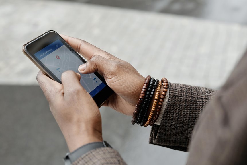
That GPS precision only matters once you know which apps actually request and use your location data. You’ll usually see route-guidance, ride-hailing, weather, fitness, and family-safety apps in this group, because they need coordinates to compute routes, nearby services, or activity logs. Check your location permissions regularly, since some apps ask for access only while you use them, while others want background tracking.
| App type | Uses location for | Typical risk |
|---|---|---|
| Maps | routing | high |
| Rideshare | pickup | medium |
| Weather | local forecasts | low |
| Fitness | route history | medium |
| Social | tagging | variable |
Use app access settings to limit unnecessary sharing and keep your data aligned with your needs. That way, you stay in control while still fitting into the connected services your circle uses.
Turn On and Manage Location Services
To keep location-based apps accurate, you need location services enabled at both the system and app level. Open your phone’s Settings, find Location, and turn it on.
Then review each app’s location permissions so you’re granting access only where it supports your workflow, whether you choose While Using or Always. Whenever an app must refresh maps, safety alerts, or family tracking, allow background updates; otherwise, restrict them to reduce unnecessary data use.
On Android and iPhone, you can also check precise location, system services, and recent access logs to confirm which apps are active. Whenever you manage these controls carefully, you stay connected to the tools your group relies on without exposing more data than you need.
Save Battery While Using GPS
Once location services are enabled, the next constraint is power use, because GPS can drain a phone faster than most background features.
You should lower screen brightness, since the display often costs more energy than the receiver during trips. Use battery saver modes when you only need periodic updates, and switch to low power route guidance whenever your app supports it. You can also disable unnecessary background apps, because they compete for CPU time and radio access. Download maps before you leave, so your phone doesn’t keep querying data over cellular networks. Should you be traveling with others, share one active route guidance device and let the rest conserve charge. That way, your group stays coordinated, and your phone lasts through the route.
Protect Your Location Privacy
Because location data can reveal your home, routines, and contacts, you should treat GPS access as a security setting, not just a convenience feature. Review location privacy controls on your phone and in each app, then allow access only whenever the function truly needs it.
Use consent based tracking limits to define who can see you, whenever they can see you, and for how long. Prefer “while using” permissions over always-on access, and disable background sharing for apps that don’t need continuous telemetry.
Audit saved places, shared maps, and activity history regularly, because they can expose patterns that identify you. If you’re part of a family group or team, align expectations so everyone understands what data gets shared, with whom, and why.
When Phone GPS Stops Working
Even with tight privacy controls, phone GPS can stop working whenever the device loses the signals and data it needs to compute position. You’ll see it fail indoors, between tall buildings, or in rural zones where satellite and cellular coverage weaken.
Your phone usually needs four or more satellites, plus Wi-Fi or cell towers, to refine latitude and longitude quickly. Should battery drain issues force power-saving mode, location updates can slow or stop. A damaged gps antenna can also block reception, causing drifting pins or no fix at all.
You should check permissions, restart location services, and move to open sky. Should the problem persist, your device may need repair or replacement, especially whenever the whole community relies on accurate shared location data.
Frequently Asked Questions
How Does GPS Differ From Cellular Triangulation?
GPS pinpoints your location using signals from satellites in orbit, while cellular triangulation estimates it from nearby cell towers. GPS usually gives much finer accuracy, whereas triangulation often works better indoors but is generally less precise.
Can a Phone Track Altitude Using GPS?
Yes, a phone can track altitude with GPS, but altitude readings are usually more accurate when the device also uses a barometric sensor. Combining satellite data with pressure measurements helps reduce error and gives more dependable elevation estimates.
Does Location Tracking Work Without Internet Access?
Yes, location tracking can still function without internet because it relies on satellite signals. Offline maps can still display your position. You will not get live data sync, but GPS remains active. In an emergency, you can still navigate, although cellular coverage can improve accuracy.
What Happens if the Phone Battery Dies?
When the phone battery runs out, location tracking ends at once. Real time updates, saved history, and notifications stop. With no power, the device cannot send its position until it is charged and turned back on.
Are Dedicated GPS Trackers More Reliable Than Phone Apps?
Yes, dedicated GPS trackers are usually more reliable than phone apps because they have their own power source and are less affected by weak phone battery performance or app-related interruptions. They also tend to hold location data more consistently in rural areas, indoors, and crowded places where phone signals can be less dependable.